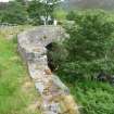
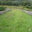
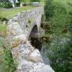
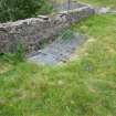
Old Crubenmore Bridge, over River Truim, Newtonmore
Ordnance Survey licence number AC0000807262. All rights reserved. © Copyright and database right 2024. Public Sector Viewing Terms
Useful Links
- Canmore:
- CRUBENMORE, OLD BRIDGE
- Historic Scotland:
- HS Reference No 7664
General Details and Location
Category
AT RISK
Name of Building
Old Crubenmore Bridge
Other Name(s)
Address
over River Truim, Newtonmore
Locality
Postcode
Planning Authority
Divisional Area
Reference No
6091
Listing Category
B
OS Grid Ref
NN 67653 91339
Location Type
Rural
HS Reference No
7664
Description
Substantial double span rubble bridge; pair segmental dressed rubble arch rings; splayed approaches abut arches with crude long-short masonry angle detailing. Low rubble parapets; curved approach from E bank.
Now by-passed Military road re-aligned between Dalwhinnie and Drumochter during programme military road alterations 1798-1813. River Truim forms boundary with Laggan Parish. Bridge repaired 1975 as a conservation project. (Historic Environment Scotland List Entry)
Now by-passed Military road re-aligned between Dalwhinnie and Drumochter during programme military road alterations 1798-1813. River Truim forms boundary with Laggan Parish. Bridge repaired 1975 as a conservation project. (Historic Environment Scotland List Entry)
Building Dates
1800-10
Architects
Category of Risk and Development History
Condition
Poor
Category of Risk
Moderate
Exemptions to State of Risk
Not to be confused with C-listed Crubenmore Bridge.
Field Visits
28/6/2017
Development History
22 January 2016: Nominated for the Register by a member of the public as suffering scour to pier, an arch fracture with collapsed fill and hole in deck. For Investigation.
28 June 2017: Inspection finds part of the deck has collapsed over the east archway and the central pier is showing signs of damage. Moved to At Risk.
Availability
Current Availability
Unknown
Appointed Agents
Price
Occupancy
Vacant
Occupancy Type
Present/Former Uses
Name of Owners
Unverified see FAQ on ascertaining ownership
Type of Ownership
Unknown
Information Services
Additional Contacts/Information Source
Bibliography
Online Resources
Classification
Roads and Paths
Original Entry Date
22-JAN-16
Date of Last Edit
17/07/2017


