Notice

Following a review of the Buildings at Risk Register we have paused the Register while we consider options for its future.
The website will remain accessible and searchable during this time, but it will not be updated and we’re not accepting nominations for additions to the Register. If you need to contact us about the BARR please email hmenquiries@hes.scot

Read the review report here and you can find out more about why we have paused the BARR on our news centre.

Fannyside Mill, Fannyside

+ -
Ordnance Survey licence number AC0000807262. All rights reserved. © Copyright and database right 2024. Public Sector Viewing Terms

General Details and Location

Category
AT RISK
Name of Building
Fannyside Mill
Other Name(s)
Address
Fannyside
Locality
Postcode
Planning Authority
Divisional Area
Reference No
969
Listing Category
B
OS Grid Ref
NS 80991 73351
Location Type
Rural
HS Reference No
1073

Description

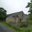
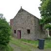
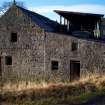
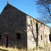
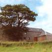
Plain 2 storey cornmill of rubble and slate, with a retained internal wheel and a dated inset lintel. The lade runs in from the west, behind the farm building with sluice to the north west of the mill, from the easternmost of the Fannyside Lochs. The mills was altered and extended in the early 19th century.
Building Dates
Dated 1763; early 19th alteration and extension
Architects
Unknown

Category of Risk and Development History

Condition
Poor
Category of Risk
Moderate
Exemptions to State of Risk
The adjacent farmhouse and steading are not at risk.
Field Visits
June 1993, 04/02/2008, 27/05/2010, 17/12/2014
Development History

June 1993: External inspection reveals the mill to be deteriorating and unmaintained.

1996: SCT receives information that the elderly owner has died and the entire property, including the small farmhouse and steading, is being marketed by Langley-Taylor of Edinburgh.

November 1996: SCT receives information that the property has been sold.

February 1998: SCT receives information that at least 2 further changes of ownership have taken place.

March 1998: Planning Permission is sought for the alteration and extension of the farmhouse to form a residential dwelling. Works commence.

January 2002: Local plannners report that the farmhouse has been substantially repaired and appears occupied. As yet, no proposals have been submitted for the cornmill.

April 2003: Local planners report no change.

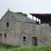
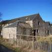
February 2008: External inspection finds the mill to remain derelict. Part of one extension has now lost its slate roof. Most windows are broken and missing. The are plants growing in mortar joints.
May 2010: External inspection finds that the building appears to be largely unchanged from our previous visit. Externally, the most obvious deterioration is in the pointing on the west elevation where large cracks are more pronounced, though these appear to be stable.
17 December 2014: External inspection finds minor repairs have been undertaken to the lower piended section of the building but the main roof has deteriorated since the previous site visit. Otherwise, the building remains in much the same condition as seen previously. Full Planning Permission and Listed Building Consent for restoration and conversion of the former mill into a dwelling were lodged but withdrawn ref: 08/00728/FUL & 08/00727/LBC.
12 November 2019: A member of the public notes further deterioration at the site - roofs have now collapsed.
20 May 2024: Desk-based assessment suggests the building remains At-Risk.

Guides to Development

Conservation Area
Planning Authority Contact
PAC Telephone Number

Availability

Current Availability
Unknown
Appointed Agents
Price
Occupancy
Vacant
Occupancy Type
N/A
Present/Former Uses
Building Uses Information:
Present Use 1: N/A Former Use 1: Mill
Present Use 2: N/A Former Use 2: N/A
Name of Owners
Type of Ownership
Private

Information Services

Additional Contacts/Information Source
Bibliography
Online Resources
Classification
Farming
Original Entry Date
17-JUN-93
Date of Last Edit
07/01/2021