Notice

Following a review of the Buildings at Risk Register we have paused the Register while we consider options for its future.
The website will remain accessible and searchable during this time, but it will not be updated and we’re not accepting nominations for additions to the Register. If you need to contact us about the BARR please email hmenquiries@hes.scot

Read the review report here and you can find out more about why we have paused the BARR on our news centre.

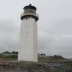
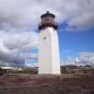
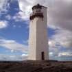
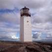
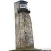
Southerness Lighthouse, Southerness

+ -
Ordnance Survey licence number AC0000807262. All rights reserved. © Copyright and database right 2024. Public Sector Viewing Terms

General Details and Location

Category
AT RISK
Name of Building
Southerness Lighthouse
Other Name(s)
Address
Southerness
Locality
Postcode
Planning Authority
Divisional Area
Reference No
1169
Listing Category
A
OS Grid Ref
NX 97745 54282
Location Type
Rural Settlement
HS Reference No
10415

Description

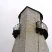
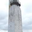
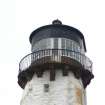
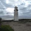
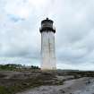
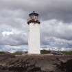
Peter Milligan of Burran mason of 1748 navigational marker pillar; subsequently heightened at instigation of Mrs Oswald of Auchencruive. Became a lighthouse probably circa 1811: raised to present height by Walter Newall 1842-3: disused from 1867 until re-opening 4.8.1894 following thorough modernisation. Tall, slightly battered square-plan lighthouse tower. Painted rubble. 3 angles curved inwards at upper level towards curved and glazed light opening: curved parapet walkway on corbels in front of latter. Segmental- arched and boarded door with iron "yett" at foot of east face. Curved, low-pitched slate roof with apex ventilator. Internal wooden stair.

Built and formerly maintained by Dumfries Town Council. Original pillar contracted to be 30' high, and it was recommended that a beacon be placed on it; 1837 report gives height as 36'. OSA report suggests a "greater advantage were lights placed in it". Marked on Ainslies map of 1797 as a "land mark" (see SRO RHP 37657). "Lighthouse" keeper appointed 1811. Now disused. (Historic Scotland)
Building Dates
1748; c.1785; 1842-1843
Architects
Peter Milligan; Walter Newall

Category of Risk and Development History

Condition
Fair
Category of Risk
Low
Exemptions to State of Risk
Field Visits
November 1994, 22/08/2008, 11/05/2011, 8/5/2014
Development History

1 March 1993: The Scotsman reports on efforts to restore the lighthouse.
November 1994: External inspection reveals the lighthouse to be disused, though in reasonable condition with the roof repaired. Dumfries and Galloway Regional Council has suggested a combined approach with the owner to the repainting of the exterior.
1995: SCT understands the lighthouse may now have been sold.
March 1998: SCT understands that there are plans to upgrade the lighthouse in connection with business use and a proposed visitors' centre.
13 May 2004: The Galloway News reports on the building's inclusion on the Buildings at Risk Register.

August 2008: External inspection reveals that the lighthouse remains disused. It appears that it is being maintained. There is one broken pane and minimal plant growth on the walls.
May 2011: External inspection finds that since the previous site visit the condition of the paint and timber elements has deteriorated. The walkway is in need of repair with the loss of fabric along the outer edge at the join with the balustrade.
8 May 2014: Inspection finds the structure is now open to visitors to generate income towards maintenance for the structure. Access to the upper walkway is not permitted.

Guides to Development

Conservation Area
Planning Authority Contact
PAC Telephone Number

Availability

Current Availability
Not Available
Appointed Agents
Price
Occupancy
Vacant
Occupancy Type
N/A
Present/Former Uses
Building Uses Information:
Present Use 1: N/A Former Use 1: Lighthouse
Present Use 2: N/A Former Use 2: N/A
Name of Owners
Type of Ownership
Private

Information Services

Additional Contacts/Information Source
Bibliography
Online Resources
Classification
Shipping
Original Entry Date
30-JUN-93
Date of Last Edit
07/01/2021