Notice
Following a review of the Buildings at Risk Register we have paused the Register while we consider options for its future.
The website will remain accessible and searchable during this time, but it will not be updated and we’re not accepting nominations for additions to the Register. If you need to contact us about the BARR please email hmenquiries@hes.scot
Read the review report here and you can find out more about why we have paused the BARR on our news centre.
Moin House, Tongue
Ordnance Survey licence number AC0000807262. All rights reserved. © Copyright and database right 2025. Public Sector Viewing Terms
Useful Links
- Canmore:
- MOIN HOUSE
- Historic Scotland:
- HS Reference No 18455
General Details and Location
Category
AT RISK
Name of Building
Moin House
Other Name(s)
Moine House
Address
Tongue
Locality
Postcode
Planning Authority
Divisional Area
Reference No
1418
Listing Category
C
OS Grid Ref
NC 51835 60047
Location Type
Rural
HS Reference No
18455
Description
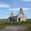
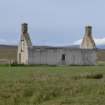
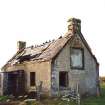
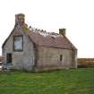
Simple single storey, 3-bay cottage. All harled. Centre door masked by later projecting porch with side entrance. Single window in east return gable with large, but worn plaque in centre with ashlar margins. Skewputts project from return gables in Sutherland tradition, coped end stacks; slate roof.
Built to serve as refuge for travellers crossing the isolated, high ground of the Moin Worn inscription commemorates construction of road (by Duke of Sutherland) in 1830. (Historic Scotland)
Earliest known roadside refuge (that wasn't an inn) in the Highlands. From Tongue, Moin House is clearly visible on the skyline. (E.Beaton)
Building Dates
Dated 1830
Architects
Unknown
Category of Risk and Development History
Condition
Ruinous
Category of Risk
Low
Exemptions to State of Risk
Field Visits
November 1994, 21/6/2012, 25/9/2013
Development History
3 December 1993: The Aberdeen Press and Journal reports that permissions are being sought by the Hope and Melness Estate to remove the remaining timbers and to cap the walls in order to stabilise its dangerous condition. The application includes a screen to protect the plaque, and a turning area and parking (ref: SU/1993/415). Plans for use as an education and interpretation centre have now fallen through. November 1994: External inspection reveals the house to be ruinous, now bypassed by the new road. 1995: The property passes to the Melness Crofters' Estate. May 2000: Local planners report that the building remains vacant, but has been consolidated.
21 June 2012: External inspection finds all that remains of the building are the walls. The interior has been spray painted.
25 September 2013: External inspection finds the building remains a ruin.
22 February 2024: Desk-based assessment suggests the site remains disused.
Availability
Current Availability
Unknown
Appointed Agents
Price
Occupancy
Vacant
Occupancy Type
N/A
Present/Former Uses
Name of Owners
Melness Crofters' Estate
Type of Ownership
Unknown
Information Services
Additional Contacts/Information Source
Bibliography
Sutherland An Illustrated Architectural Guide E. Beaton (1995), p91
Online Resources
Classification
Cottages and Lodges
Original Entry Date
06-NOV-97
Date of Last Edit
01/07/2014


