Notice
Following a review of the Buildings at Risk Register we have paused the Register while we consider options for its future.
The website will remain accessible and searchable during this time, but it will not be updated and we’re not accepting nominations for additions to the Register. If you need to contact us about the BARR please email hmenquiries@hes.scot
Read the review report here and you can find out more about why we have paused the BARR on our news centre.
Possil Railway Station (Former), 477- 479, Balmore Road, Possil
Ordnance Survey licence number AC0000807262. All rights reserved. © Copyright and database right 2025. Public Sector Viewing Terms
Useful Links
- Canmore:
- GLASGOW, 477, 479 BALMORE ROAD, POSSIL STATION
- Historic Scotland:
- HS Reference No 33744
General Details and Location
Category
AT RISK
Name of Building
Possil Railway Station (Former)
Other Name(s)
Address
477- 479, Balmore Road, Possil
Locality
Postcode
Planning Authority
Divisional Area
Reference No
2684
Listing Category
C
OS Grid Ref
NS 58763 68855
Location Type
Urban
HS Reference No
33744
Description
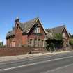
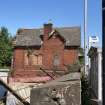
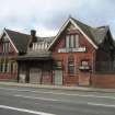
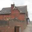
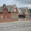
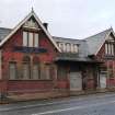
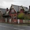
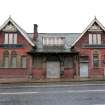
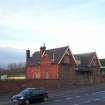
Built for Lanarkshire and Dumbarton Railway, high level station converted to offices. Symmetrical, single storey and attic, 3-bay building with wide gables to outer bays. Red brick with decorative timber framing in gable heads, plain timber bargeboards, moulded terracotta tympana over central lights of ground floor windows. Central arched entrance with deeply swept roof over forming canopy. Outer bays with paired central arched windows and flanking flat-headed windows, all in architraves, some alteration in N bay, tripartites in gables, 6-light, long, low swept roofed dormer at centre. Various windows on side elevations and half gableted against each main stack on end wall. Slate roof with red ridge tiles. (Historic Scotland)
The two storey and attic office builing spanned the through tracks and '...entered at first floor level from the street...'. There was a goods shed (6 bay brick) and a goods office (5 bays). The platform shelter (of wood) was demolished in 1967. It is noted that the station was closed in 1908, re-opened in 1934 and closed once more in 1964. (J Hume)
The two storey and attic office builing spanned the through tracks and '...entered at first floor level from the street...'. There was a goods shed (6 bay brick) and a goods office (5 bays). The platform shelter (of wood) was demolished in 1967. It is noted that the station was closed in 1908, re-opened in 1934 and closed once more in 1964. (J Hume)
Building Dates
circa 1897
Architects
Unknown
Category of Risk and Development History
Condition
Very Poor
Category of Risk
High
Exemptions to State of Risk
Field Visits
October 1997, 13/11/2007, 03/11/2010, 10/6/2014, 02/06/2023
Development History
1990: Historic Scotland reports that the station is in poor condition. October 1997: External inspection reveals the station to be vacant and boarded up. October 1999: Local planners report that the station has now been vacant for many years, though the disused railway tunnel over which it stands has now been repaired. November 2007: External inspection reveals the building to be derelict with windows boarded up and doors roller-shuttered. The roof is in poor condition - there are many slipped or missing slates and the timber bargeboarding is decaying.
July 2009: First Scotrail forward recent images of the former railway station and advise the former old Caledonian Railway station closed to passengers in October 1964.
November 2010: External inspection finds the building continues to deteriorate. At each visit more slates have been lost and the condition of the timber elements is worse. Plants are gaining ground on the roof and in surviving gutters.
20 November 2013: Local planners report the building remains in much the same condition as when last visited. No redevelopment plans have been lodged for the site.
10 June 2014: External inspection finds the building has significantly deteriorated with large sections of slate loss/ eaves collapse. Condition moved to Very Poor and Risk to High.
13 September 2018: A member of the public advises safety precautions around the building has been erected - a traffic management system has been installed.
17 October 2018: Local planners note the site appears to be under marketing for sale. It is unclear who the appointed agent is.
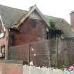
2 June 2023: External inspection finds that the condition continues to deteriorate. There appears to be signs of bowing of the main ridge running north-south. Loss of roof slates continues and there are now holes and bare sarking visible. The rainwater goods on the front elevation have been damaged. Mature vegetation growth is visible on the masonry and the roof. The previously noted security fencing is now damaged and pushed over, no longer securing the area along the front elevation.
Guides to Development
Conservation Area
Planning Authority Contact
PAC Telephone Number
0141 287 5492
Availability
Current Availability
Not Available
Appointed Agents
Price
Occupancy
Vacant
Occupancy Type
N/A
Present/Former Uses
Building Uses Information:
Present Use 1: N/A Former Use 1: Railway Station
Present Use 2: N/A Former Use 2: N/A, BARR original text : Railway Station to Offices
Present Use 1: N/A Former Use 1: Railway Station
Present Use 2: N/A Former Use 2: N/A, BARR original text : Railway Station to Offices
Name of Owners
Kingsacre Investments
Type of Ownership
Company
Information Services
Additional Contacts/Information Source
Bibliography
The industrial archaeology of Glasgow (1974) JR Hume p278
Online Resources
Classification
Railways
Original Entry Date
01-OCT-97
Date of Last Edit
04/06/2021


