Notice
Following a review of the Buildings at Risk Register we have paused the Register while we consider options for its future.
The website will remain accessible and searchable during this time, but it will not be updated and we’re not accepting nominations for additions to the Register. If you need to contact us about the BARR please email hmenquiries@hes.scot
Read the review report here and you can find out more about why we have paused the BARR on our news centre.
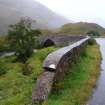
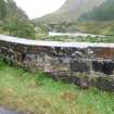
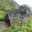
Bridge near Site of Battle of Glenshiel, Over River Shiel
Ordnance Survey licence number AC0000807262. All rights reserved. © Copyright and database right 2024. Public Sector Viewing Terms
Useful Links
- Canmore:
- DROCHAID BEUL-ATH CHEAPAIN BRIDGE
- Historic Scotland:
- HS Reference No 7212
General Details and Location
Category
AT RISK
Name of Building
Bridge near Site of Battle of Glenshiel
Other Name(s)
Address
Over River Shiel
Locality
Postcode
Planning Authority
Divisional Area
Reference No
2791
Listing Category
B
OS Grid Ref
NG 99029 13205
Location Type
Rural
HS Reference No
7212
Description
Wide single span stone arched bridge; coursed rubble, dressed stone arched ring; buttressed abutments. Long curved approach to north; dressed stone parapet.
Parliamentary road from Glenmoriston to Shiel Bridge built in 1815. Bridge now by-passed by new alignment of A87 road.(Historic Scotland)
Road remade by Telford for the Commission for Highland Roads and Bridges, it was described by William Daniell in 1817 as one of the " best engineered and best made roads in Scotland". ( M. Miers)
Building Dates
circa 1815
Architects
Thomas Telford
Category of Risk and Development History
Condition
Fair
Category of Risk
Low
Exemptions to State of Risk
Field Visits
14/09/2010, 4/6/2013
Development History
May 1993: SCT receives reports that the stone parapets have suffered damage, with some stonework now lost. The bridge is now bypassed by the re-aligment of the A87.
August 2010: External inspection finds the south parapet is in need of repointing. In one section the inner masonry has fallen out. Both parapets have extensive plant growth on their outer walls. Moved to At Risk
4 June 2013: Inspection finds no significant change from the previous site visit. As the condition appears stable, risk level moved to Low.
23 February 2024: Desk-based assessment suggests the building remains disused.
Availability
Current Availability
Unknown
Appointed Agents
Price
Occupancy
Vacant
Occupancy Type
N/A
Present/Former Uses
Building Uses Information:
Present Use 1: N/A Former Use 1: Bridge
Present Use 2: N/A Former Use 2: N/A
Present Use 1: N/A Former Use 1: Bridge
Present Use 2: N/A Former Use 2: N/A
Name of Owners
Unverified see FAQ on ascertaining ownership
Type of Ownership
Unknown
Information Services
Additional Contacts/Information Source
Am Baile: http://www.ambaile.org.uk/en/item/item_photograph.jsp?item_id=128331
Bibliography
The Western Seaboard an illustrated architectural history (2008) Mary Miers p 164
Online Resources
Highland Council HER: http://her.highland.gov.uk/SingleResult.aspx?uid=MHG16818
Classification
Roads and Paths
Original Entry Date
06-MAY-93
Date of Last Edit
14/10/2013


