Notice
Following a review of the Buildings at Risk Register we have paused the Register while we consider options for its future.
The website will remain accessible and searchable during this time, but it will not be updated and we’re not accepting nominations for additions to the Register. If you need to contact us about the BARR please email hmenquiries@hes.scot
Read the review report here and you can find out more about why we have paused the BARR on our news centre.
High Bridge, Over River Spean
Ordnance Survey licence number AC0000807262. All rights reserved. © Copyright and database right 2025. Public Sector Viewing Terms
Useful Links
- Canmore:
- SPEAN BRIDGE, GENERAL WADE'S HIGH BRIDGE
- Historic Scotland:
- HS Reference No 6841
General Details and Location
Category
AT RISK
Name of Building
High Bridge
Other Name(s)
Address
Over River Spean
Locality
Postcode
Planning Authority
Divisional Area
Reference No
2795
Listing Category
B
OS Grid Ref
NN 20059 82108
Location Type
Rural
HS Reference No
6841
Description
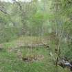
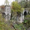
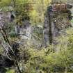
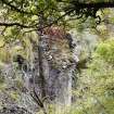
High 3 arched rubble bridge; segmental headed dressed rubble arch rings; triangular cutwaters rising as stepped buttresses at each end abutments. Smaller east bank arch survives; section remains of cast-iron footbridge placed over missing spans, now also collapsed. Fragments of pulvinated string course survive.
High Bridge superseded by Thomas Telford's Spean Bridge further up stream. Said to have been (and still is') inscribed "In the ninth year of His Majesty King George II this bridge was erected under the care of Lt General Wade, Commander in Chief of all Forces in North Britain, 1736." In poor condition and difficult to examine owing both to condition and over-grown vegetation. (Historic Scotland)
High Bridge superseded by Thomas Telford's Spean Bridge further up stream. Said to have been (and still is') inscribed "In the ninth year of His Majesty King George II this bridge was erected under the care of Lt General Wade, Commander in Chief of all Forces in North Britain, 1736." In poor condition and difficult to examine owing both to condition and over-grown vegetation. (Historic Scotland)
Building Dates
1737
Architects
General Wade
Category of Risk and Development History
Condition
Ruinous
Category of Risk
Low
Exemptions to State of Risk
Field Visits
October 1992, 13/09/2010, 13/10/2011, 31/5/2013
Development History
October 1992: External inspection reveals the bridge to be ruinous. A smaller arch survives at the east bank, though the rest of the bridge has collapsed. A cast-iron footbridge has been placed over the missing spans, though this too has collapsed. Fragments of pulvinated string coursing survive.
September 2010: Site visit attempted but inaccessible due to flooding.
October 2011: Inspection finds sections of the iron footbridge remain. The abutment to the east bank and the middle abutment survive. Vegetation growth threatens the remaining masonry structures. However, overall, much of the bridge remains in similar condition to 1992.
31 May 2013: Inspection finds there are signs that suggest some further areas of the bridge are in danger of future collapse. Risk level raised to High.
13 July 2015: Local planners note some consolidation works were carried out on the bridge since our previous visit. Risk level reduced to Low.
23 February 2024: Desk-based assessment suggests the building remains At-Risk.
Availability
Current Availability
Unknown
Appointed Agents
Price
Occupancy
Vacant
Occupancy Type
N/A
Present/Former Uses
Building Uses Information:
Present Use 1: N/A Former Use 1: Bridge
Present Use 2: N/A Former Use 2: N/A
Present Use 1: N/A Former Use 1: Bridge
Present Use 2: N/A Former Use 2: N/A
Name of Owners
Unverified see FAQ on ascertaining ownership
Type of Ownership
Unknown
Information Services
Additional Contacts/Information Source
http://her.highland.gov.uk/SingleResult.aspx?uid=MHG3184
Bibliography
Online Resources
Classification
Roads and Paths
Original Entry Date
01-OCT-92
Date of Last Edit
13/07/2015


