Notice
Following a review of the Buildings at Risk Register we have paused the Register while we consider options for its future.
The website will remain accessible and searchable during this time, but it will not be updated and we’re not accepting nominations for additions to the Register. If you need to contact us about the BARR please email hmenquiries@hes.scot
Read the review report here and you can find out more about why we have paused the BARR on our news centre.
Rosneath Castle Bathwell, Dark Wood, Rosneath
Ordnance Survey licence number AC0000807262. All rights reserved. © Copyright and database right 2025. Public Sector Viewing Terms
Useful Links
- Canmore:
- ROSNEATH CASTLE POLICIES, BATHWELL
- Historic Scotland:
- HS Reference No 42625
General Details and Location
Category
AT RISK
Name of Building
Rosneath Castle Bathwell
Other Name(s)
Address
Dark Wood, Rosneath
Locality
Postcode
Planning Authority
Divisional Area
Reference No
2979
Listing Category
A
OS Grid Ref
NS 26408 81940
Location Type
Rural
HS Reference No
42625
Description
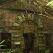
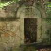
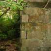
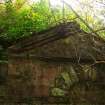
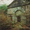
Single storey, 3-bay, rectangular-plan classical bathwell. Pink sandtone ashlar with polished cream and green ashlar deeply channelled rustication and dressings; brick-lined interior. String course, cornice, pediment.
N (ENTRANCE) ELEVATION: square door set into semi-circular arch at centre, voussoirs, rustication. Flanking windows set into rusticated masonry, shallow keystones; string course runs along line of springing of arch. Pediment.
W AND E ELEVATIONS: square-headed window set into semicircular arched recess at centre.
INTERIOR: brick-lined, joist holes; opening broken through back wall. Recess at SW angle with flue channel. (Historic Scotland)
Formed part of the estate of Rosneath Castle, a country house demolished in the 1960s.
Building Dates
Mid-later 18th century
Architects
Unknown
Category of Risk and Development History
Condition
Ruinous
Category of Risk
Critical
Exemptions to State of Risk
Field Visits
01/09/1995, 14/10/2008, 09/12/2009, 25/10/2012
Development History
September 1995: External inspection reveals the bathwell to be derelict and collapsing. November 2007: A member of the public contacts SCT concerned at the deterioration of the structure.
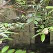
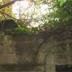
October 2008: External inspection finds the bathwell in ruinous condition. There is much evidence of plant and tree growth within the structure. The roof has collapsed and much masonry is now surrounding the building. There is evidence of structural movement of the walls. Internal brick-lined walls are also at risk of collapsing.
December 2009: External inspection finds the bathwell remains in a ruinous state, fast approaching a completely ruinous state.
25 October 2012: External inspection finds vegetation continues to engulf the building. The ground around is very damp.
Availability
Current Availability
Unknown
Appointed Agents
Price
Unknown
Occupancy
Vacant
Occupancy Type
N/A
Present/Former Uses
Name of Owners
Unknown
Type of Ownership
Unknown
Information Services
Additional Contacts/Information Source
Bibliography
1st edition OS map 1860. Ian G Lindsay and Mary Cosh INVERARY AND THE DUKES OF ARGYLL (1973) p133. John Gifford WILLIAM ADAM 1689-1748 pp32, 36-37, 161 (1989). F A Walker and F Sinclair NORTH CLYDE ESTUARY (1992) p104.
Online Resources
Classification
Ancillary Buildings
Original Entry Date
12-SEP-95
Date of Last Edit
17/01/2013


