Notice
Following a review of the Buildings at Risk Register we have paused the Register while we consider options for its future.
The website will remain accessible and searchable during this time, but it will not be updated and we’re not accepting nominations for additions to the Register. If you need to contact us about the BARR please email hmenquiries@hes.scot
Read the review report here and you can find out more about why we have paused the BARR on our news centre.
Charlestown Harbour, East Harbour Road, Charlestown
Ordnance Survey licence number AC0000807262. All rights reserved. © Copyright and database right 2025. Public Sector Viewing Terms
Useful Links
- Canmore:
- CHARLESTOWN HARBOUR
- Historic Scotland:
- HS Reference No 3756
General Details and Location
Category
AT RISK
Name of Building
Charlestown Harbour
Other Name(s)
East Harbour Road; Limekilns Harbour
Address
East Harbour Road, Charlestown
Locality
Postcode
Planning Authority
Divisional Area
Reference No
3221
Listing Category
B
OS Grid Ref
NT 06604 83469
Location Type
Rural Settlement
HS Reference No
3756
Description
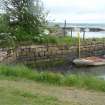
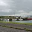
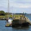
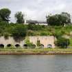
Sickle shaped inner pier with rounded end and truncated, squared off section to create an inner harbour. Two long, round-ended linear piers enclose the outer harbour. Eastern pier built up to create a further outer harbour in the later 19th century.
Charles, the 5th Earl of Elgin, created Charlestown as a model village from 1759 until his death in 1771, when it was continued by his successors. He exploited the abundance of raw materials around Charlestown which led to the establishment of a foundry, brick works, limekilns, the export of coal and coke, the development of the village to house the workers and the necessary transport for the materials which included wagonways and the harbour. The proximity of the limekilns to the harbour meant that the lime could be shovelled directly onto boats for exportation.
The harbour was also used for passenger steamers in the 19th century which ran from Granton to Stirling stopping at Charlestown amongst other ports. In 1863 the North British Railway Company bought the harbour and extended it to the E, there was a railway running along the Harbour Road and a station to the E at Saltpans. Although the harbour was extended to cope with the growing trade, towards the end of the century the use of the railway and competition from other ports such as Grangemouth led to a decline in the amount of commercial activity. However, shipbreaking began in the 1920s under the Alloa Shipbreaking Co. and ended in 1962. The harbour was also requisitioned by the Admiralty in WWII to berth crafts.
The harbour is now used for pleasure craft. The timber skeleton of a circa 1900 hexagonal harbour light stands at the end of the W pier but is not part of the Statutory List. (Historic Scotland).
Building Dates
Mid 18th century with later extensions
Architects
Unknown
Category of Risk and Development History
Condition
Very Poor
Category of Risk
Moderate
Exemptions to State of Risk
The Inner Pier is excluded from this entry as it is a designated Scheduled Monument.
Field Visits
10/2007, 22/07/2010, 21/5/2014, 29/4/2019
Development History
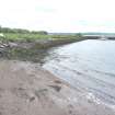
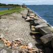
October 2007: External inspection reveals the harbour to be in very poor condition in places. The habour would benefit from ongoing maintenance and repairs.
June 2010: Fife and Kinross Extra reports that the pier has been identified as being one of the two most notable buildings At Risk in Charlestown in a report to the South West Fife area council committee.
July 2010: External inspection finds no significant change from the previous site visit, deterioration continues.
21 May 2014: Inspection finds the harbour remains in much the same condition as seen previously.
29 April 2019: External inspection finds no significant change from previous visit. Structure continues to slowly decline; substantial vegetation encroaching.
Guides to Development
Conservation Area
Charlestown
Planning Authority Contact
PAC Telephone Number
Availability
Current Availability
Unknown
Appointed Agents
Price
Unknown
Occupancy
Part
Occupancy Type
N/A
Present/Former Uses
Building Uses Information:
Present Use 1: N/A Former Use 1: N/A
Present Use 2: N/A Former Use 2: N/A
Present Use 1: N/A Former Use 1: N/A
Present Use 2: N/A Former Use 2: N/A
Name of Owners
Unverified see FAQ on ascertaining ownership
Type of Ownership
Unknown
Information Services
Additional Contacts/Information Source
Bibliography
T Sharp, C Greenwood, W Fowler, MAP OF THE COUNTIES OF FIFE AND KINROSS, 1828; A Graham, ARCHAEOLOGICAL NOTES ON SOME HARBOURS IN EASTERN SCOTLAND, PSAS, 101, 1968-1969, p223; J Hume, THE INDUSTRIAL ARCHAEOLOGY OF SCOTLAND, 1976, p132; N Fotheringham, CHARLESTOWN, 1997; J Hume, HARBOUR LIGHTS, SVBWG, 1997, p16; additional information courtesy of the Earl of Elgin and Kincardine.
Online Resources
Classification
Shipping
Original Entry Date
07-NOV-07
Date of Last Edit
20/11/2014


