Notice
Following a review of the Buildings at Risk Register we have paused the Register while we consider options for its future.
The website will remain accessible and searchable during this time, but it will not be updated and we’re not accepting nominations for additions to the Register. If you need to contact us about the BARR please email hmenquiries@hes.scot
Read the review report here and you can find out more about why we have paused the BARR on our news centre.
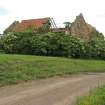
Ballencrieff Granary, Ballencrieff
Ordnance Survey licence number AC0000807262. All rights reserved. © Copyright and database right 2025. Public Sector Viewing Terms
Useful Links
- Canmore:
- BALLENCRIEFF GRANARY
- Historic Scotland:
- HS Reference No 6528
General Details and Location
Category
AT RISK
Name of Building
Ballencrieff Granary
Other Name(s)
Address
Ballencrieff
Locality
Postcode
Planning Authority
Divisional Area
Reference No
3563
Listing Category
A
OS Grid Ref
NT 48568 78109
Location Type
Rural Settlement
HS Reference No
6528
Description
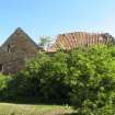
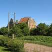
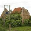
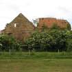
2-storey, L-plan former house and granary. Random rubble with freestone dressings. Irregular openings, several now built up; doorways at 1st floor formerly with forestair and with corbel course above indicating position of former lean-to, large modern sliding doors inserted at ground of NE gable. No internal communications between ground and 1st floor; access by ladder. Red pantiles, coped askews; crowstepped to E with brick stack. 6 beak skewputts, 3 with shields bearing arms.
A hospital dedicated to St Cuthbert is documented at Ballencrieff in the 13th century. This later building was apparently connected with it, as was Redhouse, formerly known as Red Spittal ( Historic Scotland)
A hospital dedicated to St Cuthbert is documented at Ballencrieff in the 13th century. This later building was apparently connected with it, as was Redhouse, formerly known as Red Spittal ( Historic Scotland)
Building Dates
16th century, with later alterations.
Architects
Unknown
Category of Risk and Development History
Condition
Very Poor
Category of Risk
High
Exemptions to State of Risk
Field Visits
12/06/2008, 28/04/2011, 3/12/2014
Development History
June 2008: External inspection finds the Granary in very poor condition; the roof has collapsed in many areas and there is substantial foliage growth evident within and around the structure.
April 2011: External inspection finds no significant change from the previous site visit - deterioration continues.
20 December 2012: Local planners report the building remains at risk.
3 December 2014: External inspection finds the building remains in much the same condition as seen previously.
Guides to Development
Conservation Area
Planning Authority Contact
PAC Telephone Number
01620 827264
Availability
Current Availability
Unknown
Appointed Agents
Price
Occupancy
Vacant
Occupancy Type
N/A
Present/Former Uses
Name of Owners
Unverified see FAQ on ascertaining ownership
Type of Ownership
Unknown
Information Services
Additional Contacts/Information Source
Bibliography
RCAHMS, INVENTORY OF EAST LOTHIAN NO 6, p5. C McWilliam Lothian (1978) p90. W Forrest, Map of Haddingtonshire, 1799.
Online Resources
Classification
Farming
Original Entry Date
05-AUG-08
Date of Last Edit
23/01/2015


