Notice
Following a review of the Buildings at Risk Register we have paused the Register while we consider options for its future.
The website will remain accessible and searchable during this time, but it will not be updated and we’re not accepting nominations for additions to the Register. If you need to contact us about the BARR please email hmenquiries@hes.scot
Read the review report here and you can find out more about why we have paused the BARR on our news centre.
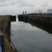
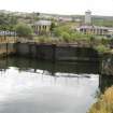
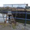
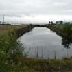
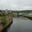
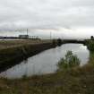
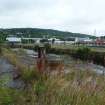
Scott's Dry Dock and Outer Basin, Rue End Street, Greenock
Ordnance Survey licence number AC0000807262. All rights reserved. © Copyright and database right 2025. Public Sector Viewing Terms
Useful Links
- Canmore:
- GREENOCK, CARTSBURN SHIPYARD, SCOTT LITHGOW LTD, DRY DOCK
- Historic Scotland:
- HS Reference No 50131
General Details and Location
Category
AT RISK
Name of Building
Scott's Dry Dock and Outer Basin
Other Name(s)
Submarine Dock
Address
Rue End Street, Greenock
Locality
Postcode
Planning Authority
Divisional Area
Reference No
3588
Listing Category
A
OS Grid Ref
NS 28717 75788
Location Type
Urban
HS Reference No
50131
Description
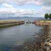
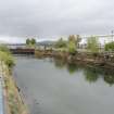
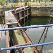
Oblong dry dock roughly 110m long and 20m wide, with semi-octagonal S end, stepped sides, later steel gates, and outer basin to N. Sandstone ashlar. 2 steeply sloped ramps on each side. Iron rings at regular intervals along cobbled quayside. Remains of cast-iron operating machinery including capstan with Stothert & Pitt of Bath maker's plate. Rectangular outer basin (partly filled in to E side) with roughly 20m entrance to Clyde. Also known as the Submarine Dock.
Situated in Cartsdyke, off Rue End Street, between Victorian Harbour and the T-Mobile office. It is believed to be the oldest surviving dry (or graving) dock in Scotland. There are 8 dry docks currently (2005) listed in Scotland, the oldest of which is the one in Troon, which was built in 1840s; all the others were built in the 2nd half of the 19th century. Built for Steele's shipyard, which occupied this site until it closed in 1883, at which point it was taken over by Scott's. James Steele was born in Ayr, and started his career building fishing vessels and coasters in Saltcoats. He later joined partnership with John Carswell, and the firm Steele and Carswell moved to Greenock in 1796. It is therefore possible (although unlikely) that the dry dock dates from this time. In 1816 the Steele and Carswell partnership was dissolved and Steele joined partnership with his sons, Robert and James. In the 1820s the firm began building steam ships, and it is likely that dry dock was built at about this time. The dry dock and outer basin are shown on John Wood's Town Plan of 1825; the 1838 town plan is more specific, marking the graving dock in 'Mr Steele's Ship Building Yard'. It is interesting to note that the Dry Dock in East India Harbour, which was completed in 1823, is marked as 'New Graving Dock' on the 1838 map, which perhaps suggests that Steele's dock was older.
The dock was extended between the publication of the 1st and 2nd edition OS maps, probably when the yard was purchased by Scott's. (Historic Scotland)
Building Dates
Early 19th century
Architects
Built for Steeles shipyard
Category of Risk and Development History
Condition
Poor
Category of Risk
Moderate
Exemptions to State of Risk
Field Visits
18/08/2008, 22/01/2010, 30/08/2011, 13/8/2014
Development History
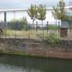
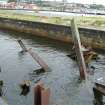
August 2008: External inspection reveals that the dock is flooded with water. Fencing surrounds the structure with signs which state that the quayside is dangerous. Metal beams block the entrance into the outer basin and the steel gates and other metal fixtures appear corroded. The stepped masonry sides of the dock are overgrown with vegetation and some of the masonry appears to be loose.
December 2008: Local planners report that the dry dock is now owned by Riverside Inverclyde regeneration company.
January 2010: External inspection finds no change to the condition of the dry dock from previous visit.
August 2011: External inspection finds no significant change since the previous site visit.
13 August 2014: Inspection finds the former dock remains in poor condition.
30 March 2017: The McLean Museum advise the dock probably dates from 1818 and built at the same time as the Lamonts Dry Dock.
June 2019: A member of the public notes the beams in the outer neck of the dock (noted during the last site visit) appear to have been removed.
3 July 2024: BBC news website reported (26/02/2024) on concerns for the ongoing disuse of the dry dock, and attempts to revive the site.
Guides to Development
Conservation Area
Planning Authority Contact
PAC Telephone Number
01475 712418
Availability
Current Availability
Unknown
Appointed Agents
Price
Occupancy
Vacant
Occupancy Type
N/A
Present/Former Uses
Name of Owners
Riverside Inverclyde
Type of Ownership
Company
Information Services
Additional Contacts/Information Source
Bibliography
Shown on John Wood, `Plan of the Town of Greenock from Actual Survey', 1825 and `Plan of the town of Greenock and its environs' by Andrew MacFarlane 1838-1842 (courtesy of Watt Museum, Greenock). Shown on 1st edition OS map circa 1857). Extension to S shown on 2nd edition OS map (circa 1898). SHIPPING AND SHIPBUILDING RECORD (1948, Volume 71 No 4, Jan 22nd p109-112 (article on Steele's Shipyard with undated old photograph of dry dock). George Woods, ROBERT STEELE II, (2004) article on Inverclyde Council, Museum & Art Gallery website.
Online Resources
Classification
Shipbuilding
Original Entry Date
22-AUG-08
Date of Last Edit
23/07/2018


