Notice
Following a review of the Buildings at Risk Register we have paused the Register while we consider options for its future.
The website will remain accessible and searchable during this time, but it will not be updated and we’re not accepting nominations for additions to the Register. If you need to contact us about the BARR please email hmenquiries@hes.scot
Read the review report here and you can find out more about why we have paused the BARR on our news centre.
Craigrownie Parish Church, Shore Road, Cove
Ordnance Survey licence number AC0000807262. All rights reserved. © Copyright and database right 2025. Public Sector Viewing Terms
Useful Links
- Canmore:
- COVE AND KILCREGGAN, SHORE ROAD, CRAIGROWNIE PARISH CHURCH
- Historic Scotland:
- HS Reference No 43432
General Details and Location
Category
AT RISK
Name of Building
Craigrownie Parish Church
Other Name(s)
Craigrownie Church Hall
Address
Shore Road, Cove
Locality
Postcode
Planning Authority
Divisional Area
Reference No
4198
Listing Category
B
OS Grid Ref
NS 22487 80863
Location Type
Rural Settlement
HS Reference No
43432
Description
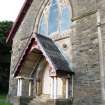
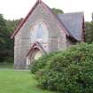
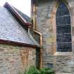
Gabled, hall-church, originally built for United Presbyterian Church, now church hall. Long rectangular-plan aligned NE-SW. Rubble with pink sandstone, droved margins; base course; chamfered reveals, quoin strips, projecting timber eaves. Leaded lying-pane glazing; grey slate roof, terracotta ridge coping, wooden eaves; variegated patterned slate at porch.
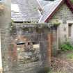
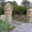
GATEPIERS AND BOUNDARY WALL: 2 stylised robust irregular pairs of gatepiers at N and S; vertically laid ashlar masonry with stugged sandstone bands, stone ogival caps with polished ashlar finials (finial missing from outer right pier); slightly battered base. Gatepiers to outer left and right substantially larger, swept down to fasten at smaller pier only, remaining gate to outer right, timber construction, hanging post with 2 boarded panels with cast-iron reinforcements.
Rubble whinstone boundary wall with harl-pointed boulder coping with some sea boulders.
The building was built as a United Presbyterian Church in 1869 but now functions as Craigrownie Church Hall. The gatepiers are closely modelled on the design for gatepiers by Alexander Thomson illustrated in VILLA AND COTTAGE ARCHITECTURE. (Historic Scotland)
Building Dates
1869; later additions
Architects
Hugh Barclay
Category of Risk and Development History
Condition
Fair
Category of Risk
Low
Exemptions to State of Risk
Field Visits
10/09/2009, 25/10/2012
Development History
September 2009: External inspection finds the building empty and advertised for sale. It is generally in good condition but is being vandalised. Planning permission is being sought for conversion of the building to flats with new build to the rear (July 2009 ref: 09/0116/LIB)
25 October 2012: External inspection finds no significant change from the previous site visit. The grounds to the church are becoming overgrown. Full Planning Permission for conversion of the church to 8 flats with 2 new build houses in the grounds have been conditionally approved ref: 09/01464/PP & 09/01461/LIB Dec 2009 and Feb 2010. A previous application for conversion to 8 flats with 9 new flats in the grounds having been withdrawn.
21 April 2017: A member of the public notes the condition of the property is deteriorating and that vandalism is ongoing at the site.
7 December 2022: The Helensburgh Advertiser published an article on 02/12/2022 stating that planning permission for the conversion to a dwelling has been granted. The permissions are for alterations, restoration and change of use of historic community building to form dwellinghouse (ref:22/00992/PP and 22/00991/LIB).
Guides to Development
Conservation Area
Cove and Kilcreggan
PAC Telephone Number
Availability
Current Availability
Unknown
Appointed Agents
Price
Occupancy
Vacant
Occupancy Type
N/A
Present/Former Uses
Name of Owners
Type of Ownership
Unknown
Information Services
Additional Contacts/Information Source
Bibliography
OS 1st edition map, 1865. F A Walker and F Sinclair NORTH CLYDE ESTUARY (1992) p109. F H Groome ORDNANCE GAZETEER OF SCOTLAND Vol ii, p298. OS 1st edition map, 1865. Sketches of the Churches and Clergy in the Parish of Row, Rosneath and Cardross (1889) pp165-169.
Online Resources
Classification
Churches and Chapels
Original Entry Date
17-SEP-09
Date of Last Edit
30/06/2023


