Notice
Following a review of the Buildings at Risk Register we have paused the Register while we consider options for its future.
The website will remain accessible and searchable during this time, but it will not be updated and we’re not accepting nominations for additions to the Register. If you need to contact us about the BARR please email hmenquiries@hes.scot
Read the review report here and you can find out more about why we have paused the BARR on our news centre.
Baron's Folly, Down Law
Ordnance Survey licence number AC0000807262. All rights reserved. © Copyright and database right 2025. Public Sector Viewing Terms
Useful Links
- Canmore:
- DOWN LAW, BARON'S FOLLY
- Historic Scotland:
- HS Reference No 15099
General Details and Location
Category
AT RISK
Name of Building
Baron's Folly
Other Name(s)
Address
Down Law
Locality
Postcode
Planning Authority
Divisional Area
Reference No
4214
Listing Category
C
OS Grid Ref
NT 63719 26797
Location Type
Rural
HS Reference No
15099
Description
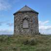
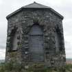
Octagonal summerhouse and observatory with piended roof surmounted by iron finial. Gothick pointed window openings on three sides, boarded up. Later wooden door to NE. Random rubble with dark whinstone pinnings and rusticated quoins on window and door openings. Welsh slate roof.
Prominently situated on summit of Down Law within the Fairnington estate. Baron´s Folly was built as a summerhouse and observatory by Baron Robert Rutherford, merchant, into whose hands the estate of Fairnington passed in c.1777. It is described as a summerhouse on John Ainslie´s 'Map of the Southern Part of Scotland´ of 1821 but by 1843 is recorded as 'Baron´s Folly´. It is visible from several miles away from every direction and is an important feature in the landcape. (Historic Scotland)
Prominently situated on summit of Down Law within the Fairnington estate. Baron´s Folly was built as a summerhouse and observatory by Baron Robert Rutherford, merchant, into whose hands the estate of Fairnington passed in c.1777. It is described as a summerhouse on John Ainslie´s 'Map of the Southern Part of Scotland´ of 1821 but by 1843 is recorded as 'Baron´s Folly´. It is visible from several miles away from every direction and is an important feature in the landcape. (Historic Scotland)
Building Dates
1780-90
Architects
Unknown
Category of Risk and Development History
Condition
Poor
Category of Risk
Moderate
Exemptions to State of Risk
Field Visits
25/08/2011, 23/09/2009
Development History
September 2009: External inspection reveals that the roof of the folly is in a state of disrepair. Several small holes are apparent and the timber ridge poles are loose or missing in sections. Some of the timber boarding covering the window opening is missing leaving the interior neither wind nor watertight.
August 2011: Limited inspection possible - building could only be viewed from afar. The roof remains and windows are still boarded.
29 March 2023: Member of the public reports that the roof continues to leak allowing water ingress to the building and the windows have not been replaced, however the walls remain in reasonable condition.
Guides to Development
Conservation Area
Planning Authority Contact
PAC Telephone Number
Availability
Current Availability
Unknown
Appointed Agents
Price
Occupancy
Vacant
Occupancy Type
N/A
Present/Former Uses
Name of Owners
Type of Ownership
Unknown
Information Services
Additional Contacts/Information Source
Bibliography
K Cruft, J Dunbar and R Fawcett, Buildings of Scotland: Borders (2006), p275.
Online Resources
56982
Classification
Ancillary Buildings
Original Entry Date
30-SEP-09
Date of Last Edit
23/07/2018


