Notice
Following a review of the Buildings at Risk Register we have paused the Register while we consider options for its future.
The website will remain accessible and searchable during this time, but it will not be updated and we’re not accepting nominations for additions to the Register. If you need to contact us about the BARR please email hmenquiries@hes.scot
Read the review report here and you can find out more about why we have paused the BARR on our news centre.
Dysart Harbour, Dysart
Ordnance Survey licence number AC0000807262. All rights reserved. © Copyright and database right 2025. Public Sector Viewing Terms
Useful Links
- Canmore:
- DYSART HARBOUR
- Historic Scotland:
- HS Reference No 36406
General Details and Location
Category
AT RISK
Name of Building
Dysart Harbour
Other Name(s)
Address
Dysart
Locality
Postcode
Planning Authority
Divisional Area
Reference No
4298
Listing Category
B
OS Grid Ref
NT 30200 92800
Location Type
Urban
HS Reference No
36406
Description
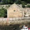
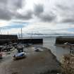
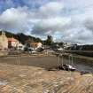
Roughly U-plan tidal basin with harbour mouth to S (at rounded end) and slipway to N; W arm with jetties projecting at W and NW forming mouth to almost rhomboidal-plan wet dock at NW. E pier with high ashlar sea wall to SE. Harbour walls largely ashlar, parts in vertical courses; stone sets to slipways. (ref: Historic Scotland)
Building Dates
Early 17th century tidal basin; 1831 wet dock; restored 1967.
Architects
Category of Risk and Development History
Condition
Poor
Category of Risk
High
Exemptions to State of Risk
Field Visits
03/08/2018
Development History
December 2009: Local planners nominate the Harbour for inclusion on the Register. The east pier was badly damaged in storms and whilst repaired the repair was only given a limited life which is fast ending and the next major storm may destroy it. An engineer's report confirmed the core is rapidly being washed away. The Council are considering applying for grant aid towards the repair.
3 August 2018: Inspection finds the harbour in Fair to Poor condition. There is loose mortar to some of the stonework and there is a portion of collapsed masonry at the North section to the South East of the Harbourmaster's House.
Guides to Development
Conservation Area
Dysart
Planning Authority Contact
PAC Telephone Number
Availability
Current Availability
Not Available
Appointed Agents
Price
Occupancy
Unknown
Occupancy Type
Unknown
Present/Former Uses
Name of Owners
Type of Ownership
Local Authority
Information Services
Additional Contacts/Information Source
Bibliography
Online Resources
Classification
Shipping
Original Entry Date
07-DEC-09
Date of Last Edit
02/12/2014


