Notice
Following a review of the Buildings at Risk Register we have paused the Register while we consider options for its future.
The website will remain accessible and searchable during this time, but it will not be updated and we’re not accepting nominations for additions to the Register. If you need to contact us about the BARR please email hmenquiries@hes.scot
Read the review report here and you can find out more about why we have paused the BARR on our news centre.
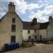
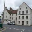
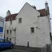
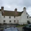
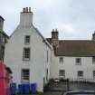
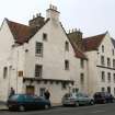
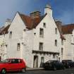
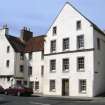
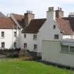
Sailors Walk, 443-449, High Street, Kirkcaldy
Ordnance Survey licence number AC0000807262. All rights reserved. © Copyright and database right 2025. Public Sector Viewing Terms
Useful Links
- Canmore:
- KIRKCALDY, 443-449 HIGH STREET, SAILOR'S WALK
- Historic Scotland:
- HS Reference No 36358
General Details and Location
Category
AT RISK
Name of Building
Sailors Walk
Other Name(s)
Address
443-449, High Street, Kirkcaldy
Locality
Postcode
Planning Authority
Divisional Area
Reference No
4863
Listing Category
A
OS Grid Ref
NT 28446 92059
Location Type
Urban
HS Reference No
36358
Description
3-storey and attic, 3-bay, H-plan former Customs House (right gable) and town house/fisher tenement block, converted to offices and shop circa 1970. Harled with painted margins. Volute corbel table and crowstepped gable to W, corbelled stair and moulded string course (later) to E; stop-chamfered arrises.
Reputedly the oldest building in Kirkcaldy with a house recorded on this site in 1460. Sailor's Walk, possibly originated as two dwellings of wealthy merchants or shipowners and was due for demolition in the late 1940s, but was taken over by the National Trust for Scotland and restored in the 1950s with additional funding from the Historic Buildings Council and public appeal. A fire (started by vandals) in 1994 caused charring and discoloration of the 1st floor painted ceiling. At the time of The Inventory, the western house was derelict and the more easterly had tabled skews with scrolled skewputts, and two string courses crossed the gable. The panel bearing the Arms of Charles II was originally sited on the east elevation and is dated either 1662 (when Charles confirmed the Royal Charter of the town) or 1682. The principal room of the west house (with plasterwork decoration) has been known as 'The Queen Mary Room', possibly connected with Mary of Guise. Coming into single ownership in 1826, Sailor's Walk was known as Oliphant's House until the early 20th century. (Historic Scotland)
Reputedly the oldest building in Kirkcaldy with a house recorded on this site in 1460. Sailor's Walk, possibly originated as two dwellings of wealthy merchants or shipowners and was due for demolition in the late 1940s, but was taken over by the National Trust for Scotland and restored in the 1950s with additional funding from the Historic Buildings Council and public appeal. A fire (started by vandals) in 1994 caused charring and discoloration of the 1st floor painted ceiling. At the time of The Inventory, the western house was derelict and the more easterly had tabled skews with scrolled skewputts, and two string courses crossed the gable. The panel bearing the Arms of Charles II was originally sited on the east elevation and is dated either 1662 (when Charles confirmed the Royal Charter of the town) or 1682. The principal room of the west house (with plasterwork decoration) has been known as 'The Queen Mary Room', possibly connected with Mary of Guise. Coming into single ownership in 1826, Sailor's Walk was known as Oliphant's House until the early 20th century. (Historic Scotland)
Building Dates
17th century incorporating prob 15th c. fabric; 1954-9; later alterations
Architects
Unknown; 1954-9 restoration Wheeler & Sproson.
Category of Risk and Development History
Condition
Fair
Category of Risk
Minimal
Exemptions to State of Risk
Field Visits
31/08/2010, 16/03/2011, 28/5/2014, 25/07/2018
Development History
August 2010: SCT conducts an accompanied internal and external inspection with the building owners, and finds the building in fair overall condition. Only part of the ground floor retail units are in use, and the upper floors are all vacant. There is a flooding issue to part of the (vacant) ground floor unit that is currently under investigation. There are signs of penetrating damp to the upper floors.
20 December 2012: Local planners advise the owners are considering options for the building.
24 June 2013: NTS advise an Options Appraisal is well underway for the building and that new tenant for one of the ground floor retail units has also been found.
28 May 2014: External inspection finds the building in fair condition but appears to remain disused.
25 July 2018: External inspection finds the building is much the same condition as seen previously. There is some vegetation growth to the rear entrance. The walls are showing signs of lack of maintenance.
12 October 2022: Planning permission has been granted for change of use of the ground floor from gallery (Class 1) to office (Class 4) (ref:22/02369/FULL).
Guides to Development
Conservation Area
Kirkcaldy Harbour and Port Brae
Planning Authority Contact
PAC Telephone Number
Availability
Current Availability
Not Available
Appointed Agents
Price
Occupancy
Vacant
Occupancy Type
N/A
Present/Former Uses
Name of Owners
National Trust for Scotland
Type of Ownership
Charity/Trust
Information Services
Additional Contacts/Information Source
Bibliography
Online Resources
Classification
Middle-sized Houses
Original Entry Date
03-FEB-11
Date of Last Edit
27/11/2014


