Notice
Following a review of the Buildings at Risk Register we have paused the Register while we consider options for its future.
The website will remain accessible and searchable during this time, but it will not be updated and we’re not accepting nominations for additions to the Register. If you need to contact us about the BARR please email hmenquiries@hes.scot
Read the review report here and you can find out more about why we have paused the BARR on our news centre.
East Pier, Kirkcaldy Harbour, Kirkcaldy
Ordnance Survey licence number AC0000807262. All rights reserved. © Copyright and database right 2025. Public Sector Viewing Terms
Useful Links
- Canmore:
- KIRKCALDY, DOCK AND HARBOUR
- Historic Scotland:
- HS Reference No 44067
General Details and Location
Category
AT RISK
Name of Building
East Pier
Other Name(s)
Address
Kirkcaldy Harbour, Kirkcaldy
Locality
Postcode
Planning Authority
Divisional Area
Reference No
4902
Listing Category
B
OS Grid Ref
NT 28549 91932
Location Type
Urban
HS Reference No
44067
Description
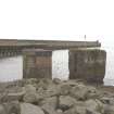
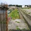
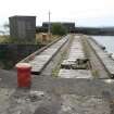
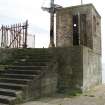
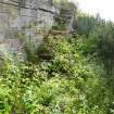
At least 3 builds. N section 2-stage comprising walkway and parapet; coursed rubble sandstone on natural bedrock; steps up to walkway. Middle section (circa 1845): 2-stage comprising walkway and parapet; droved ashlar sandstone (lifting points exposed); round-arched semicircular recesses. S section (1909): parapet and quay; pre-cast concrete; cast-iron pawls.
Part of predominantly 19th and 20th centuries harbour and docks, encasing earlier structures. The harbour has been on this site since at least the 17th century, and was known by 1676 as the 'old' and 'new' harbours. Some early structure appears to have been incorporated into the N part of the current inner dock, possibly 1756 extension, and in 1797 authorisation was granted to deepen the new basin. A railway connection was brought to the harbour in 1849, and the NSA mentions major planned improvements to harbour extension of E pier, drawn up by civil engineer James Leslie of Dundee. This almost certainly relates to the middle section of the existing pier, which was carried out in fine ashlar work. Harbour duties formed an important source of income to the town, and much money was expended by the town council to ensure that the harbour continued to meet the requirements of traders. Further extension of the E pier and enlargement of the outer basin took place in 1909, at the height of the linoleum trade. Trade with the Continent prior to the Union included coal, salt and salted fish; Kirkcaldy remained a busy harbour at the start of this century with exports including linoleum, paper, malt, grain and textiles. During WWI it was taken over by the American Navy, and finally closed in 1929. (Historic Scotland)
Part of predominantly 19th and 20th centuries harbour and docks, encasing earlier structures. The harbour has been on this site since at least the 17th century, and was known by 1676 as the 'old' and 'new' harbours. Some early structure appears to have been incorporated into the N part of the current inner dock, possibly 1756 extension, and in 1797 authorisation was granted to deepen the new basin. A railway connection was brought to the harbour in 1849, and the NSA mentions major planned improvements to harbour extension of E pier, drawn up by civil engineer James Leslie of Dundee. This almost certainly relates to the middle section of the existing pier, which was carried out in fine ashlar work. Harbour duties formed an important source of income to the town, and much money was expended by the town council to ensure that the harbour continued to meet the requirements of traders. Further extension of the E pier and enlargement of the outer basin took place in 1909, at the height of the linoleum trade. Trade with the Continent prior to the Union included coal, salt and salted fish; Kirkcaldy remained a busy harbour at the start of this century with exports including linoleum, paper, malt, grain and textiles. During WWI it was taken over by the American Navy, and finally closed in 1929. (Historic Scotland)
Building Dates
Predominantly 19th and 20th centuries
Architects
Extension possibly James Leslie of Dundee
Category of Risk and Development History
Condition
Very Poor
Category of Risk
High
Exemptions to State of Risk
Field Visits
31/08/2010, 28/5/2014, 25/07/2018
Development History
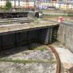
August 2010: Inspection finds the massive structure derelict and disused.
April 2011: The Courier reports the harbour/ docks will be welcoming cargo ships for the first time in 20 years. Construction work is to commence for the instatement new silos & conveyors to enable the fast delivery of wheat. Dredging work is also expected to commence during Spring. The project is reported to be a partnership between Forth Ports & Hutchison‘s Flour. The project is to be support by a grant from Scottish Government of £829,000, as part of a commitment to encourage the transfer of haulage off roads.
October 2011: A member of the public advises the harbour has now officially re-opened, as reported in The Herald and Fife Free Press. Listed building consent for the demolition of the single storey brick structure was conditionally approved June 2011 ref: 11/01410/LBC.
28 May 2014: Inspection finds the structure remains in much the same condition as seen previously.
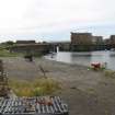
25 July 2018: Inspection finds the pier in much the same condition as seen previously. Access along the pier appears to be restricted with security metal fencing so it was not possible to assess the condition of the structures more closely.
9 August 2018: FifeToday.co.uk reports damage to the harbour caused by extreme stormy weather. (09/08/2018)
Guides to Development
Conservation Area
Kirkcaldy Harbour and Port Brae
Planning Authority Contact
PAC Telephone Number
Availability
Current Availability
Unknown
Appointed Agents
Price
Occupancy
Part
Occupancy Type
Unknown
Present/Former Uses
Name of Owners
Unverified see FAQ on ascertaining ownership
Type of Ownership
Unknown
Information Services
Additional Contacts/Information Source
Bibliography
Online Resources
Classification
Roads and Paths
Original Entry Date
19-APR-11
Date of Last Edit
27/11/2014


