Notice
Following a review of the Buildings at Risk Register we have paused the Register while we consider options for its future.
The website will remain accessible and searchable during this time, but it will not be updated and we’re not accepting nominations for additions to the Register. If you need to contact us about the BARR please email hmenquiries@hes.scot
Read the review report here and you can find out more about why we have paused the BARR on our news centre.
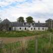
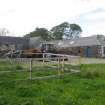
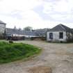
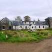
Armadale Steading, Armadale Castle Policies, Ardvasar
Ordnance Survey licence number AC0000807262. All rights reserved. © Copyright and database right 2024. Public Sector Viewing Terms
Useful Links
- Canmore:
- SKYE, ARMADALE, HOME FARM, HIGH SQUARE
- Historic Scotland:
- HS Reference No 14007
General Details and Location
Category
AT RISK
Name of Building
Armadale Steading
Other Name(s)
Address
Armadale Castle Policies, Ardvasar
Locality
Postcode
Planning Authority
Divisional Area
Reference No
5013
Listing Category
B
OS Grid Ref
NG 64033 05061
Location Type
Rural
HS Reference No
14007
Description
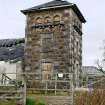
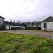
Coursed rubble; contrasting pale sand-stone dressings to dovecot. Large U-plan farm square open to south: 3 stage dovecot tower at SW (with ground floor workshop and heated room 1st floor); flightholes within small arched recesses; bracketted alighting ledges; deep eaves; pyramidal slate roof. 2 storey rear range with 3 cart arches, and granary vents at 1st floor; ramp to granary; wheel gable (no wheel) to east. Saw mill to east (in working order). Single storey, 8 bay west range as dwelling, harled with modern box dormer and centre projecting porch.
East range contains threshing machine by R G Morton, Errol Works, with original maintenance instructions dated 1878. Farmhouse (1801, James Gillespie Graham) demolished. (Historic Scotland)
East range contains threshing machine by R G Morton, Errol Works, with original maintenance instructions dated 1878. Farmhouse (1801, James Gillespie Graham) demolished. (Historic Scotland)
Building Dates
Early 19th century: 1891 restoration following fire
Architects
Unknown; John Mackenzie, Portree
Category of Risk and Development History
Condition
Poor
Category of Risk
Moderate
Exemptions to State of Risk
Field Visits
12/10/2011, 4/6/2013
Development History
August 2011: Nominated for inclusion on the Register by the Sleat History Society and the Archaeological Society. The condition of the steading is reported as being local concern.
October 2011: External inspection finds the condition of the complex varies. Major movement and cracks are evident in the doocot tower, the cottage section has lost part of its roof. Other ranges to the complex are mostly wind and water tight at present. Rainwater goods are generally in poor condition and some slate slippage is evident to the rear range. Part of the complex appears to be in storage use.
4 June 2013: External inspection finds no significant change from the previous site visit.
7 June 2022: A member of the public has advised that the condition of the building continues to deteriorate.
23 February 2024: Desk-based assessment suggests the building remains disused.
Availability
Current Availability
Unknown
Appointed Agents
Price
Occupancy
Vacant
Occupancy Type
N/A
Present/Former Uses
BARR original text : Farm/Steading to Doocot
Name of Owners
Unverified see FAQ on ascertaining ownership
Type of Ownership
Unknown
Information Services
Additional Contacts/Information Source
Bibliography
Online Resources
Classification
Farming
Original Entry Date
14-AUG-11
Date of Last Edit
01/10/2013


