Notice
Following a review of the Buildings at Risk Register we have paused the Register while we consider options for its future.
The website will remain accessible and searchable during this time, but it will not be updated and we’re not accepting nominations for additions to the Register. If you need to contact us about the BARR please email hmenquiries@hes.scot
Read the review report here and you can find out more about why we have paused the BARR on our news centre.
The Flag Tower, Penicuik House Policies, Penicuik
Ordnance Survey licence number AC0000807262. All rights reserved. © Copyright and database right 2025. Public Sector Viewing Terms
Useful Links
- Canmore:
- PENICUIK HOUSE, TOWER
- Historic Scotland:
- HS Reference No 14638
General Details and Location
Category
AT RISK
Name of Building
The Flag Tower
Other Name(s)
Knights Law Tower; Terregles Tower
Address
Penicuik House Policies, Penicuik
Locality
Postcode
Planning Authority
Divisional Area
Reference No
5347
Listing Category
B
OS Grid Ref
NT 21994 59657
Location Type
Rural
HS Reference No
14638
Description
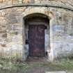
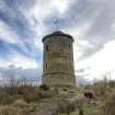
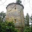
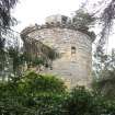
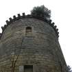
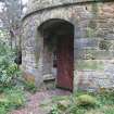
Circular. 3-Storeys. Coursed rubble. Machicolated parapet. Porch with inscription over inner door; Unusual interior: Inner tower surrounded by narrow passages. Doocot (1356 nest-holes) in 1st storey. Turnpike stair. (Historic Scotland)
Part of the designed landscape around Penicuik House, created in stages from the later 17th and 18th centuries, principle creater in the first half of the 18th century being Sir John Clerk. Acts as an eye-catcher within the estate, but also provided views from the top of the surrounding landscape. Noted as a seminal example of its type in Scotland and an early example with Britain. (Penicuik House Project)
Part of the designed landscape around Penicuik House, created in stages from the later 17th and 18th centuries, principle creater in the first half of the 18th century being Sir John Clerk. Acts as an eye-catcher within the estate, but also provided views from the top of the surrounding landscape. Noted as a seminal example of its type in Scotland and an early example with Britain. (Penicuik House Project)
Building Dates
1748-51
Architects
Sir John Clerk possibly with assistance from John Baxter
Category of Risk and Development History
Condition
Fair
Category of Risk
Low
Exemptions to State of Risk
Field Visits
26/4/2012, 14/02/2022
Development History
26 April 2012: External inspection finds a robust tower located within woodland, in a generally sound state but with significant problems at roof level. There are two trees well established plus miscellaneous other vegetation. Several corbel stones have failed and fallen to the ground.
17 July 2019: A member of the public notes repair of the structure may be imminent/ have started - surrounding vegetation having been cleared.
14 March 2022: External inspection finds that the area has been cleared of vegetation growth and larger growths removed from structure. Some visible cracking above doorway. Condition and risk have improved since last site visit, move to FAIR and LOW.
Guides to Development
Conservation Area
Planning Authority Contact
PAC Telephone Number
0131 271 3302
Availability
Current Availability
Unknown
Appointed Agents
Price
Occupancy
Vacant
Occupancy Type
N/A
Present/Former Uses
Name of Owners
Unverified see FAQ on ascertaining ownership
Type of Ownership
Unknown
Information Services
Additional Contacts/Information Source
Bibliography
Penicuik House Project Website
Online Resources
Classification
Ancillary Buildings
Original Entry Date
26-APR-12
Date of Last Edit
29/03/2022


