Notice
Following a review of the Buildings at Risk Register we have paused the Register while we consider options for its future.
The website will remain accessible and searchable during this time, but it will not be updated and we’re not accepting nominations for additions to the Register. If you need to contact us about the BARR please email hmenquiries@hes.scot
Read the review report here and you can find out more about why we have paused the BARR on our news centre.
Balnakeil Mill, Durness
Ordnance Survey licence number AC0000807262. All rights reserved. © Copyright and database right 2025. Public Sector Viewing Terms
Useful Links
- Canmore:
- BALNAKEIL MILL
- Historic Scotland:
- HS Reference No 518
General Details and Location
Category
AT RISK
Name of Building
Balnakeil Mill
Other Name(s)
Address
Durness
Locality
Postcode
Planning Authority
Divisional Area
Reference No
5381
Listing Category
B
OS Grid Ref
NC 39147 68565
Location Type
Rural
HS Reference No
518
Description
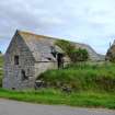
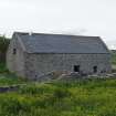
2-storey, rectangular-plan, gabled former water-powered grain mill situated on sloping site with man-made embankment to 1st-floor entrance at rear. Roughly coursed rubble with sandstone dressings. Long and short quoins and window margins. Principle elevation to NE with central door and window to right. Entrance doorway with piended roof breaking eaves to rear (SW) elevation. Irregular fenestration to gables; opening for water wheel shaft at lower ground floor to SW gable; small opening above right and further central opening at 1st floor. Ashlar-coped skews. Graded grey Scottish slate. Flue aperture in ridge to N for kiln.
Balnakeil mill is a rare surviving example of an early 19th century water powered threshing mill with kiln retaining much of its former context as well as a considerable amount of interior fabric. The building is located to the immediate S of Balnakeil House and, along with the remains of the Durness Old Parish Church and Burial Ground (see separate listing), contributes greatly to the wider landscape setting of the group as a whole.
The survival of its associated lade and its relation to the nearby listed Balnakeil House provide further interest. The corn mill was powered by water from Loch Croispol which is situated to the S of the mill. A sluice at the northern tip of the loch controlled the water from the loch into the mill lade. The lade runs along the E of the mill and a further sluice to the S fed water into the wheelpit. The high breast-shot water wheel was attached to the S elevation. The water from the wheel pit ran into an underground tail race to meet the stream which runs to the W of the mill. The lade continues from the mill towards Balnakeil House where the water drove a second water wheel. This wheel powered a threshing mill rope drive, the remains of which are situated about 100m E of the wheel. The mill was last used at sometime between 1911 and 1914, at which time it was principaly used for grinding meal.
Balnakeil sits on limestone rock, giving rise to highly fertile soil, unusual in the NW highlands. A mill on the site is shown on Timothy Pont´s map of 1590-1600. However, the present building was constructed c.1830 following the acquisition of the Reay Estate from Lord MacKay by the Duke of Sutherland.
Balnakeil House is a mid 18th century country house (listed at category A) built on the site of the summer residence of the Bishops of Sutherland and Caithness and formerly used as an occasional residence of the Lords of Reay.
This list description was updated and the category changed from C(S) to B in 2007. (Historic Scotland)
Building Dates
Early 19th century
Architects
Unknown
Category of Risk and Development History
Condition
Poor
Category of Risk
Moderate
Exemptions to State of Risk
Field Visits
21/6/2012, 25/9/2013
Development History
21 June 2012: External inspection finds the building appears to have been derelict for a number of years. The roof is in poor condition. At the north end there is a sizeable hole and sagging. At the south end there us a hole in the east pitch. Windows and doors have been lost.
25 September 2013: External inspection finds the building remains in much the same condition as seen previously.
23 February 2024: Full Planning Permission and Listed Building Consent (: 22/01504/FUL & 22/02500/LBC ) for conversion to form a holiday-let has been conditionally approved.
Availability
Current Availability
Unknown
Appointed Agents
Price
Occupancy
Vacant
Occupancy Type
N/A
Present/Former Uses
Name of Owners
Unverified see FAQ on ascertaining ownership
Type of Ownership
Unknown
Information Services
Additional Contacts/Information Source
Bibliography
Online Resources
Classification
Food and Drink Processing
Original Entry Date
03-SEP-12
Date of Last Edit
01/07/2014


