Notice
Following a review of the Buildings at Risk Register we have paused the Register while we consider options for its future.
The website will remain accessible and searchable during this time, but it will not be updated and we’re not accepting nominations for additions to the Register. If you need to contact us about the BARR please email hmenquiries@hes.scot
Read the review report here and you can find out more about why we have paused the BARR on our news centre.
Rosehaugh Mains, Avoch
Ordnance Survey licence number AC0000807262. All rights reserved. © Copyright and database right 2025. Public Sector Viewing Terms
Useful Links
- Canmore:
- ROSEHAUGH MAINS
General Details and Location
Category
AT RISK
Name of Building
Rosehaugh Mains
Other Name(s)
Address
Avoch
Locality
Postcode
Planning Authority
Divisional Area
Reference No
1716
Listing Category
Unlisted
OS Grid Ref
NH 68095 55384
Location Type
Rural
HS Reference No
Description
Former steading complex to Rosehaugh House (itself demolished in the 1950s).
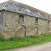
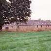
Quadrangle stone built steading, 2 storey with inner courtyard now mostly covered over. L-plan range parallel to the road features plain stone surrounds to regular openings. A large round-headed opening sits at the left end.
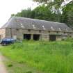
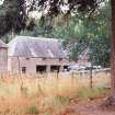
Freestanding range to the immediate North of the quadrangle runs N -S. Stone built with slated piend roof over with rooflights. West elevation has a forestair to the upper floor entrance. Ground floor openings are irregular, whilst small lights sit above. East elevation with cart shed openings witj small lights over.
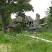
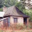
Later smithy (appears on the 2nd edition OS 1:2;500 series but not the 1st) sits to the W of the site.
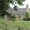
Single storey 3 bay stone built cottage with bipartite windows sits to the E of the site. Slated roof with gable end chimneys.
Building Dates
1812 with later extensions and additions
Architects
Unknown
Category of Risk and Development History
Condition
Poor
Category of Risk
Moderate
Exemptions to State of Risk
Field Visits
January 1994, 26/6/2013
Development History
January 1994: The Rosehaugh House estate is now in company ownership, and though most of the buildings are occupied, the steading remains vacant. June 1995: Agents for the owners report that although there is no plan for immediate re-use, designs have been drawn up for future residential conversion. February 2000: Local planners are unaware of any change.
26 June 2013: External inspection finds most buildings in the complex are deteriorating slowly. The detached smithy building, however, is in a near-ruinous condition
22 February 2024: Planning Permission (20/01338/FUL) for change of use and extension of agricultural building to form childrens' nursery and formation of parking area and Listed Building Consent (20/01388/LBC) for alterations and extension of agricultural building to form childrens'nursery conditionally granted 22/03/2021. Building Standards Warrant (21/02157/NDOM6) granted to convert and extend Steading to create 4 houses, 4 flats with garage workshop below and 8 separate workshops on 09/05/2023.
Availability
Current Availability
Unknown
Appointed Agents
Price
Occupancy
Vacant
Occupancy Type
N/A
Present/Former Uses
Name of Owners
Broadland Properties Ltd
Type of Ownership
Company
Information Services
Additional Contacts/Information Source
Bibliography
Beaton (1992), p13; Gifford (1992), p448; Mills (1996).
Online Resources
Classification
Farming
Original Entry Date
29-OCT-97
Date of Last Edit
30/12/2013


