Notice
Following a review of the Buildings at Risk Register we have paused the Register while we consider options for its future.
The website will remain accessible and searchable during this time, but it will not be updated and we’re not accepting nominations for additions to the Register. If you need to contact us about the BARR please email hmenquiries@hes.scot
Read the review report here and you can find out more about why we have paused the BARR on our news centre.
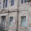
Generating Station, 95, McDonald Road, Edinburgh
Ordnance Survey licence number AC0000807262. All rights reserved. © Copyright and database right 2025. Public Sector Viewing Terms
Useful Links
- Canmore:
- EDINBURGH, MCDONALD ROAD, BOWERSHALL MILLS
- Historic Scotland:
- HS Reference No 44782
General Details and Location
Category
AT RISK
Name of Building
Generating Station
Other Name(s)
Electric Light Works (Former)
Address
95, McDonald Road, Edinburgh
Locality
Postcode
Planning Authority
Divisional Area
Reference No
2210
Listing Category
B
OS Grid Ref
NT 26102 75250
Location Type
Urban
HS Reference No
44782
Description
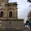
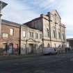
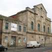
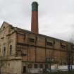
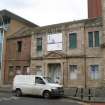
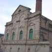
Rectangular-plan former coal-fired power generating station with Italian Renaissance basilica elevation to McDonald Road; offices and former printing works adjoining towering brick stack. Variegated brick with cream stugged ashlar elevation (painted and badly spalling); bull-blocks to SE angle of elevation.
Originally designed as an electric lighting station, used as a tramway power station and now in use as a switching station. (Historic Scotland)
Originally designed as an electric lighting station, used as a tramway power station and now in use as a switching station. (Historic Scotland)
Building Dates
1899
Architects
John Cooper, City Engineer
Category of Risk and Development History
Condition
Poor
Category of Risk
Low
Exemptions to State of Risk
Risk record applies soley to the power station building, not the chimney stack or printing works now in residential use.
Field Visits
04/11/2011, 17/2/2015, 16/10/2020
Development History
April 2001: Permissions are sought for the demolition of the offices and adjoining printworks. SCT objects but permissions are subsequently granted and the building demolished. The power station and stack remain standing. December 2003: Local planners report that the cleared site has now been redeveloped. However, the power station remains in very poor condition, most probably vacant although it may be used occasionally for storage. February 2004: Historic Scotland reports works to the building are being undertaken.
October 2009: Local planners report the property is in permanent use as a substation. Moved to ALERT at this time.
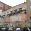
November 2011: External inspection finds the site has been partly renovated with 2 wings to the north west being converted to Housing and Offices. The main halls is reasonably intact, but boarded up. The connecting wing to the north west is in a very poor state with broken glazing to the street and a roofless section to the rear.
17 February 2015: External inspection finds the building remains in much the same condition as seen previously.
16 October 2020: External inspection finds the building in much the same condition as seen previously. Some vegetation growths are present throughout, particularly associated with rainwater goods. Signs of damp where concealed gutters appear to be blocked. Significant vegetation growths present at downpipes. Main façade is suffering from stone decay, contour scaling of ashlar being main issue. Roof not fully visible from point of survey, but some vegetation growth and slipped slates. Windows securely boarded and blocked up openings. Doors also secure. Remain At Risk. 20/03140/LBC - Retained as SP Energy Networks Transmission/Grid substation. Conditionally approved 0ct 2020
Availability
Current Availability
Unknown
Appointed Agents
Price
Occupancy
Vacant
Occupancy Type
N/A
Present/Former Uses
Building Uses Information:
Present Use 1: N/A Former Use 1: Power Station
Present Use 2: N/A Former Use 2: N/A
Present Use 1: N/A Former Use 1: Power Station
Present Use 2: N/A Former Use 2: N/A
Name of Owners
Unverified. See FAQ on ascertaining ownership
Type of Ownership
Unknown
Information Services
Additional Contacts/Information Source
Bibliography
Gifford, McWilliam and Walker (1984), p647; Hume (1976-1977), vol. I, p193; Hume (1976-1977), vol. I, p193.
Online Resources
Classification
Electricity Supply
Original Entry Date
06-JAN-04
Date of Last Edit
14/03/2022


