Notice
Following a review of the Buildings at Risk Register we have paused the Register while we consider options for its future.
The website will remain accessible and searchable during this time, but it will not be updated and we’re not accepting nominations for additions to the Register. If you need to contact us about the BARR please email hmenquiries@hes.scot
Read the review report here and you can find out more about why we have paused the BARR on our news centre.
Measured Mile Marker Pole, Shore Road, Skelmorlie
Ordnance Survey licence number AC0000807262. All rights reserved. © Copyright and database right 2025. Public Sector Viewing Terms
Useful Links
- Canmore:
- SKELMORLIE, MEASURED MILE MARKER
- Historic Scotland:
- HS Reference No 7286
General Details and Location
Category
AT RISK
Name of Building
Measured Mile Marker Pole
Other Name(s)
Address
Shore Road, Skelmorlie
Locality
Postcode
Planning Authority
Divisional Area
Reference No
4059
Listing Category
B
OS Grid Ref
NS 19193 67552
Location Type
Rural Settlement
HS Reference No
7286
Description
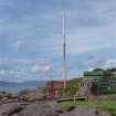
One remaining pole of 2 pairs of tall poles set 1 nautical mile from each other: poles set on concrete bases, with iron stays, and sights at upper level. Set amid rocks on the sea shore.
Erected for the use of ships undergoing tests and trials; these poles may not be the original ones. Surveyed by both Kyle and Frew, and Smith and Wharrie, land surveyors; checked by admiralty staff. Established by shipbuilders Robert Napier & Sons in 1866. (Historic Scotland)
Erected for the use of ships undergoing tests and trials; these poles may not be the original ones. Surveyed by both Kyle and Frew, and Smith and Wharrie, land surveyors; checked by admiralty staff. Established by shipbuilders Robert Napier & Sons in 1866. (Historic Scotland)
Building Dates
1866
Architects
Category of Risk and Development History
Condition
Poor
Category of Risk
Moderate
Exemptions to State of Risk
Field Visits
29/07/2009, 01/6/2012, 14/10/2014, 19/11/2019
Development History
July 2009: Inspection reveals that the iron pole has become corroded.
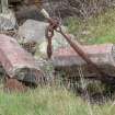
10 May 2012: Local planners advise the Measured Mile Marker has fallen to the ground - it is understood to have been damaged during the extreme storms earlier in the year.
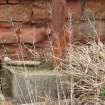
1 June 2012: Inspection finds no significant change from the previous site visit. The partner measure marker is believed to have toppled amongst the foliage behind the bus shelter in Shore Road.
14 October 2014: Inspection finds the marker remains in much the same condition as seen previously.
19 November 2019: Inspection finds corrosion is increasing down the marker - the top-most section being in the best condition, but the protective painted finish has peeled away further since the previous site visit. The base section has the heaviest rust but does appear to be well-secured within the concrete base. Only one stay is extant and in use. The marker does not seem to have any significant lean at this time. An associated marker, as noted previously, remains collapsed in a gully behind a bus stop.
Guides to Development
Conservation Area
Skelmorlie
Planning Authority Contact
PAC Telephone Number
01294 324319
Availability
Current Availability
Unknown
Appointed Agents
Price
Occupancy
Vacant
Occupancy Type
N/A
Present/Former Uses
Name of Owners
Unverified see FAQ on ascertaining ownership
Type of Ownership
Unknown
Information Services
Additional Contacts/Information Source
Bibliography
Online Resources
Classification
Shipping
Original Entry Date
31-JUL-09
Date of Last Edit
25/11/2019


