Buildings at Risk Register Paused
Following the review of the Buildings at Risk Register the decision has been taken to pause the BARR in order to consider long-term options for its future.
The existing BARR website will remain accessible as a resource, however it will not be updated and we're not accepting nominations for additions to the Register.
Downtime
Please be advised that this website will undergo scheduled maintenance on the following dates:
Sunday 23rd November 18:00 to Monday 24 November 09:00
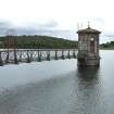
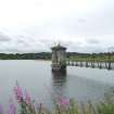
Waulkmill Glen Reservoir: Drawing off Tower, Newton Mearns
Ordnance Survey licence number AC0000807262. All rights reserved. © Copyright and database right 2026. Public Sector Viewing Terms
Useful Links
- NRHE:
- GORBALS WATER WORKS, WAULKMILL GLEN RESERVOIR VALVE TOWER
- Historic Scotland:
- HS Reference No 51186
General Details and Location
Category
AT RISK
Name of Building
Waulkmill Glen Reservoir: Drawing off Tower
Other Name(s)
Address
Newton Mearns
Locality
Postcode
Planning Authority
Divisional Area
Reference No
4752
Listing Category
A
OS Grid Ref
NS 52264 57883
Location Type
Rural
HS Reference No
51186
Description
Octagonal bull-faced masonry sub-structure with long slit openings carrying Italianate sandstone ashlar valve house with round-arched windows to each elevation divided by plain pilasters; shallow octagonal piended roof with stone slates and cast-iron finial. Rectangular-headed doorway to NNW elevation with deep corbel below supporting later iron footbridge.
Part of Waulkmill Glen reservoir, the largest of the 3 reservoirs built as part of the first phase of the Gorbals Gravitation Water Company´s water supply scheme, constructed in 1847-8. This was one of the first large-scale water supply schemes in Scotland and, although eclipsed by the slightly later scheme from Loch Katrine, is nevertheless of considerable historical and engineering interest. The draw-off tower is quite possibly the earliest such structure in Scotland. Waulkmill Glen reservoir covers an area of nearly 48 acres and has a capacity of roughly 36.5 million cubic feet. Water originally fed into the reservoir from the Brock Burn, but this arrangement was altered with the building of the Balgray reservoir (as part of the expansion of the scheme) in 1853. Water is drawn out of the reservoir through the draw-off tower, and passed through the self-activating sluice (located on the other side of the embankment dam) before discharging into the two regulating basins. From there it flowed through pipes to the low filters, which were demolished 2007-8, but were located roughly 300 yards to the NE. (ref: Historic Scotland)
Part of Waulkmill Glen reservoir, the largest of the 3 reservoirs built as part of the first phase of the Gorbals Gravitation Water Company´s water supply scheme, constructed in 1847-8. This was one of the first large-scale water supply schemes in Scotland and, although eclipsed by the slightly later scheme from Loch Katrine, is nevertheless of considerable historical and engineering interest. The draw-off tower is quite possibly the earliest such structure in Scotland. Waulkmill Glen reservoir covers an area of nearly 48 acres and has a capacity of roughly 36.5 million cubic feet. Water originally fed into the reservoir from the Brock Burn, but this arrangement was altered with the building of the Balgray reservoir (as part of the expansion of the scheme) in 1853. Water is drawn out of the reservoir through the draw-off tower, and passed through the self-activating sluice (located on the other side of the embankment dam) before discharging into the two regulating basins. From there it flowed through pipes to the low filters, which were demolished 2007-8, but were located roughly 300 yards to the NE. (ref: Historic Scotland)
Building Dates
circa 1847-8
Architects
William Gale engineer
Category of Risk and Development History
Condition
Poor
Category of Risk
Low
Exemptions to State of Risk
Field Visits
06/07/2010, 4/9/2014
Development History
July 2010: External inspection finds the building boarded-up and disused. The are grasses and bushes growing on the roof. The boarding has been graffitied.<br />
East Renfrewshire Council and Glasgow City Council are in the early stages of developing a new country park, Dams to Darnley. Part of the park covers the Barrhead Dams, a series of interconnected reservoirs, including Waulkmill, which is owned and managed by Scottish Water.
15 July 2014: Listed Building Consent for repairs to the stone slab roof is being being sought ref: 2014/0433/lbc.
4 September 2014: External inspection finds the a hole in the West pitch of the slabbed roof of the tower. Condition moved to Poor. <br />
<br />
Glasgow City Council and Renfrewshire Council continue to work to improve access to and facilities within the country park. A City Deal agreement was signed Aug 2014 between the UK Government, the Scottish Government and Clyde Valley local authorities contributing £1.3 billion to infrastructure projects across the area, of which the country park forms part.
26 January 2015: Listed Building Consent for the roof to be dismantled, new steel support trusses installed, stone slabs replaced in original locations and the replacement of damaged or missing slabs was conditionally approved Sept 2014.
Guides to Development
Conservation Area
Planning Authority Contact
PAC Telephone Number
0141 577 3876
Availability
Current Availability
Not Available
Appointed Agents
Price
Occupancy
Vacant
Occupancy Type
N/A
Present/Former Uses
Name of Owners
Scottish Water
Type of Ownership
Statutory Body
Information Services
Additional Contacts/Information Source
Dams to Darnley Country Park website: http://www.damstodarnley.org/index.php?id=73
Bibliography
Online Resources
Classification
Water Supply
Original Entry Date
15-JUL-10
Date of Last Edit
26/01/2015


