Buildings at Risk Register Paused
Following the review of the Buildings at Risk Register the decision has been taken to pause the BARR in order to consider long-term options for its future.
The existing BARR website will remain accessible as a resource, however it will not be updated and we're not accepting nominations for additions to the Register.
Downtime
Please be advised that this website will undergo scheduled maintenance on the following dates:
Sunday 23rd November 18:00 to Monday 24 November 09:00
Southern Necropolis Funerary Monuments, 316, Caledonia Road, Gorbals
Ordnance Survey licence number AC0000807262. All rights reserved. © Copyright and database right 2026. Public Sector Viewing Terms
Useful Links
- NRHE:
- GLASGOW, 316 CALEDONIA ROAD, SOUTHERN NECROPOLIS
- Historic Scotland:
- HS Reference No 33685
- HS Reference No 47416
General Details and Location
Category
AT RISK
Name of Building
Southern Necropolis Funerary Monuments
Other Name(s)
The City of the Dead
Address
316, Caledonia Road, Gorbals
Locality
Postcode
Planning Authority
Divisional Area
Reference No
4805
Listing Category
B
OS Grid Ref
NS 59399 63430
Location Type
Urban
HS Reference No
33685,47416
Description
Cemetery opened 1840, extended to east in 1846, given gate lodge in 1848 and extended to west in 1850. Containing series of high quality stone monuments, including those to Alexander Thomson and Charles Wilson. Divided into Western, Central and Eastern divisions. Boundary walls mostly ashlar, droved to street with ashlar coping. (Historic Scotland)
The Southern Necropolis replaced the old burial ground of the village of Gorbals, first established in 1770, where, by the late 1830s, all bought lairs were full and mass burial pits had had to be used during the cholera outbreak of 1832. At a public meeting in November 1839 it was proposed that the Southern Necropolis be established to "enable the working classses to become proprietors of burying places similar to those in the Necropolis, or Sighthill". By 1846 all the cheap lairs is the central section had been purchased and it was decided upon to buy more lairs, largely for cheap lairs. These too were quickly purchased and more land was purchased in later years. (Southern Necropolis Research)
The Southern Necropolis replaced the old burial ground of the village of Gorbals, first established in 1770, where, by the late 1830s, all bought lairs were full and mass burial pits had had to be used during the cholera outbreak of 1832. At a public meeting in November 1839 it was proposed that the Southern Necropolis be established to "enable the working classses to become proprietors of burying places similar to those in the Necropolis, or Sighthill". By 1846 all the cheap lairs is the central section had been purchased and it was decided upon to buy more lairs, largely for cheap lairs. These too were quickly purchased and more land was purchased in later years. (Southern Necropolis Research)
Building Dates
1840 with later extensions
Architects
Unknown
Category of Risk and Development History
Condition
Very Poor
Category of Risk
High
Exemptions to State of Risk
Field Visits
30/09/2010, 25/3/2014, 24/05/2023
Development History
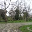
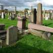
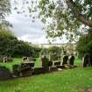
September 2010: Inspection finds the funerary monuments are in very poor condition. Some are leaning but many lie flat. Some are broken into pieces. Sometimes the pieces are stacked together, in other areas they are heaped at random or strewn across the grass.
25 October 2013: Local planners report the site remains in much the same condition as previously seen.
25 March 2014: Inspection finds the site remains in much the same condition as seen previously with many monuments toppled or leaning.
24 May 2023: External inspection finds that the monuments and grave markers remain in similar condition. There is dense vegetation growth on some sections of the walls where mounted grave markers have been covered. Some of the freestanding grave markers are also covered by vegetation growth. A number of markers mounted into the boundary wall masonry are damaged or are no longer intact.<br />
Guides to Development
Conservation Area
Planning Authority Contact
PAC Telephone Number
0141 287 5492
Availability
Current Availability
Not Available
Appointed Agents
Price
Occupancy
Vacant
Occupancy Type
N/A
Present/Former Uses
Name of Owners
Overall Cemetery - Glasgow City Council
Type of Ownership
Local Authority
Information Services
Additional Contacts/Information Source
Bibliography
Southern Necropolis Research: <a href='http://www.southernnecropolis.com/'>http://www.southernnecropolis.com/</a>
Online Resources
Southern Necropolis: <a href="http://www.southernnecropolis.com/page6.html">http://www.southernnecropolis.com/page6.html</a>
Classification
Funerary Monuments
Original Entry Date
12-OCT-10
Date of Last Edit
13/06/2014


