Notice
Following a review of the Buildings at Risk Register we have paused the Register while we consider options for its future.
The website will remain accessible and searchable during this time, but it will not be updated and we’re not accepting nominations for additions to the Register. If you need to contact us about the BARR please email hmenquiries@hes.scot
Read the review report here and you can find out more about why we have paused the BARR on our news centre.
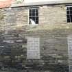
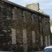
Unroofed building, Burn Street, Wick
Ordnance Survey licence number AC0000807262. All rights reserved. © Copyright and database right 2025. Public Sector Viewing Terms
Useful Links
- Canmore:
- WICK, BURN STREET, UNROOFED BUILDING
General Details and Location
Category
AT RISK
Name of Building
Unroofed building
Other Name(s)
Address
Burn Street, Wick
Locality
Postcode
Planning Authority
Divisional Area
Reference No
5369
Listing Category
Unlisted
OS Grid Ref
ND 36579 50829
Location Type
Urban
HS Reference No
Description
2 storey building in five bays. Sash and cash window frames. Chimney stack to end gable.
Telford's plan of Pulteneytown village and harbour area 1807 for the British Fisheries Society, laid out plots along Harbour Quay for 21 curing houses. The street frontages had to be filled and could be used for a dwelling house with sheds to the side, but the buildings had to be used by fish curers, fishermen, or people employed by them. Lots were advertised for sale from 1808. (Caithness A Cultural Crossroad)
The street pattern along Harbour Quay is clearly established and documented on the 1832 Great Reform Act Plan. The 1872 Large Scale Scottish Town Plan for Wick notates the yard to the rear as Curing Yard - along with all the yards running parallel to Harbour Quay. Wick grew rapidly during the 19th century to become the largest herring port in Europe.
Building Dates
Probably early 19th century
Architects
Plots laid out by Thomas Telford
Category of Risk and Development History
Condition
Poor
Category of Risk
Low
Exemptions to State of Risk
Field Visits
19/6/2012, 27/9/2013
Development History
19 June 2012: External inspection finds the building has been derelict for a number of years. It is unclear whether a flat roof has been installed, but the original roof has certainly been removed. Upper floor windows have lost their glazing while ground floor windows and doors have been blocked up.
27 September 2013: External inspection finds the building remains in much the same condition as seen previously. The building may have a flat roof, holed at the western end. A ruinous building adjoins to the East, reduced to single storey.
23 February 2024: Desk-based assessment suggests the building remains disused.
Guides to Development
Conservation Area
Wick - Pulteneytown
PAC Telephone Number
Availability
Current Availability
Unknown
Appointed Agents
Price
Occupancy
Vacant
Occupancy Type
N/A
Present/Former Uses
Name of Owners
Unverified see FAQ on ascertaining owneship
Type of Ownership
Unknown
Information Services
Additional Contacts/Information Source
Bibliography
Caithness a Cultural Crossroads (1982) ed JR Baldwin p 151-55.
Online Resources
Classification
Terraced Housing
Original Entry Date
20-AUG-12
Date of Last Edit
22/02/2018


